Summary
I am a Geospatial Technologist with 20+ years of experience delivering high-impact solutions across multinational mapping firms, startups, and UAV ventures. My expertise spans end-to-end spatial data workflows—from field acquisition (LiDAR, UAV, photogrammetry) to geospatial analytics, 3D modeling, and software automation.
I have led teams, built flying-wing drones from scratch, and published peer-reviewed research in machine learning, terrain modeling, and remote sensing. I spent my first 20 years growing up in Yogyakarta, my home town, then in 2003 I moved to Jakarta for work. I lived for almost 20 years there, and then I decided to move to Australia for new opportunities and started working in Sydney in 2022.
For a more formal résumé, visit the [Resume Page].
Core Competencies
- Geospatial Data Processing (LiDAR, Photogrammetry, 3D Modelling, Terrain Modelling)
- GIS & Remote Sensing (ArcGIS, QGIS, ENVI, GDAL)
- Programming and database administration through Python, Rust, and SQL
- Landcover classification and pattern recognition through Machine Learning frameworks (Keras, Pytorch, OpenCV)
- 3D model extraction and refining from point cloud using Realworks, CloudCompare, Rhino, and Blender
- Academic Publication & Scientific Writing
Professional Experience
Spatial Analyst
BCE Spatial Pty. Ltd., Sydney, Australia — Oct 2022 – Present
- Deliver geospatial products including maps, reports, and 3D models for planning and engineering projects.
- Responsible in the processing of 3D laser scanning and photogrammetry datasets, including 3D features extractions.
UAV LiDAR Specialist / Technical Manager
PT Tritara Orbit Surya (TOP Aerial), Jakarta — Aug 2017 – Sep 2022
- Managed UAV-based mapping missions across Indonesia.
- Directed technical R&D for drone-based LiDAR workflows, sensor calibration, and point cloud automation.
- Prepared project proposals, team training, and client workshops.
Founder / Director
PT Visiterra Teknologi Sibernetika, Jakarta — Nov 2015 – Jul 2017
- Designed and built proprietary fixed-wing drones with 60+ min endurance.
- Led all aspects of UAV photogrammetry projects—from airframe design to data delivery.
- Pioneered local UAV solutions ahead of major global adoption curves.
LiDAR Survey Engineer
PT McElhanney Indonesia, Jakarta — Jan 2011 – Oct 2015
- Responsible for airborne LiDAR field data acquisitions across Indonesia and other countries in Southeast Asia and Oceania.
- Responsible for airborne LiDAR scanner calibration, trajectory adjustment (SBET), post-processing, QA/QC, and reporting.
- Performed GPS and TLS surveys to support and augment airborne LiDAR data acquisitions.
Production Coordinator / GIS Engineer / Sales Engineer
PT ExsaMap Asia, Jakarta — Jun 2004 – Dec 2010
- Supported Intermap’s global elevation datasets (NEXTMap), handling sales, tech support, and production.
- Automated GIS workflows using ArcGIS and SQL Server, streamlining cross-office operations in Jakarta and Bangkok.
- Coordinated large-scale data integration and quality assurance efforts.
Technical Staff
PT Exsa Internasional, Jakarta — Dec 2003 – May 2004
- Focused on DEM editing, CAD drafting, and aerial photo interpretation.
Surveyor (Freelance)
Various Projects, Yogyakarta — Aug 2003 – Nov 2003
- Conducted topographic surveys using Wild T1/T2 theodolites; manual data reduction and drafting.
Lecturer Assistant
Universitas Gadjah Mada, Yogyakarta — Apr 2001 – Jul 2003
- Taught hands-on programming (BASIC) and relational database systems (dBase IV, SQL).
- Supported academic delivery of foundational computing in geomatics.
- Supported a few research projects undertaken by the University, especially in computer programming and image processing roles.
Education
Master in Geography Universitas Indonesia, Jakarta — June 2019 – August 2022
I took this master’s program while working at PT Tritara Orbit Surya, focusing on remote sensing and modeling of phenomena resulting from interactions between nature and people. I applied various machine learning models, ranging from classical approaches such as Random Forest and Support Vector Machine to deep learning models like Convolutional Neural Networks (CNN) and Long Short-Term Memory (LSTM) to model and predict landuse changes.
Thesis: Spatiotemporal Study of Rice Fields Changes in Indramayu Regency Based on the Application of Deep Learning Algorithms on Sentinel-1 Time Series Data
Bachelor in Geodesy-Geomatics Engineering Universitas Gadjah Mada, Yogyakarta — June 2001 – November 2003
Initially, I applied for Electrical Engineering but was not accepted. Instead, I was admitted to Geodetic Engineering, which I initially found uninteresting. However, as I trained in various surveying methods using optical equipment such as the theodolite and spirit level—and most memorably, those humongous Wild stereoplotters—I got hooked and decided to stay. The advent of digital photogrammetry and remote sensing, and the introduction of civilian applications of GPS sparked my interest even further.
Thesis: Semi-Automatic Extraction of Digital Terrain Model from ASTER Imagery (presented at the Annual Scientific Meeting of Indonesian Remote Sensing Society, 2003, poster session)
Languages
- English — Full professional proficiency (IELTS 7.0)
- Bahasa Indonesia — Native
Publications
1. CNN Classification Accuracy for Rural & Urban Buildings in Jambi, Indonesia
Bulletin of Geography, Socio-economic Series No. 58 (2022)
→ Lead author. Focused on training/testing convolutional neural networks on satellite imagery.
2. UAV-LiDAR Topographic Mapping of Coastal Cliffs in South Kuta, Bali
Geomatika Journal, Vol. 27 No. 1 (2021)
→ Project leader. Data acquisition, processing, and validation for high-resolution terrain modeling.
Photo Story
UAV LiDAR Specialist / Technical Manager
PT Tritara Orbit Surya (TOP Aerial), Jakarta — Aug 2017 – Sep 2022
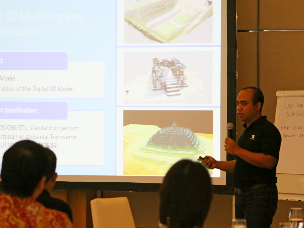
Presenting UAV LiDAR mapping at a seminar hosted by ICED-USAID, Jakarta, Indonesia (2020)
Founder / Director
PT Visiterra Teknologi Sibernetika, Jakarta — Nov 2015 – Jul 2017
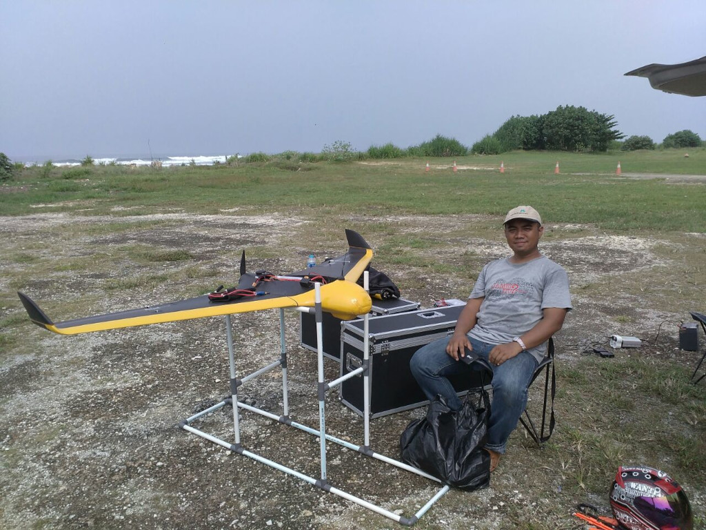
After finishing UAV survey over Pangandaran Beach, West Java, Indonesia (2016)
Airborne LiDAR Surveyor
PT McElhanney Indonesia, Jakarta — Jan 2011 – Oct 2015
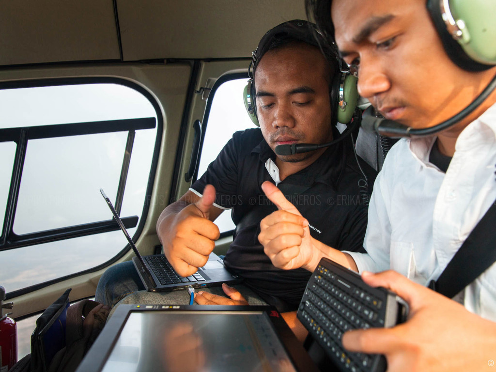
With my colleague, Jeffry, operating Leica ALS70 on AS350 helicopter somewhere over Angkor Wat, Cambodia (2014)
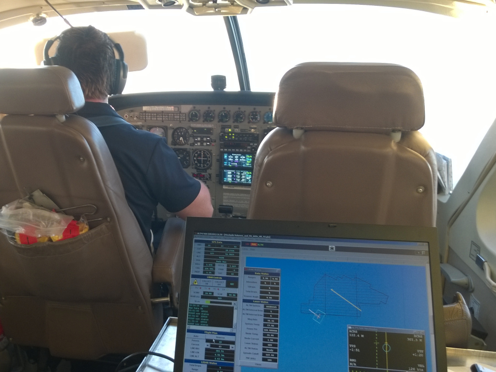
Operating Optech ALTM Orion M200 somewhere over Port Hedland, Australia (2014)
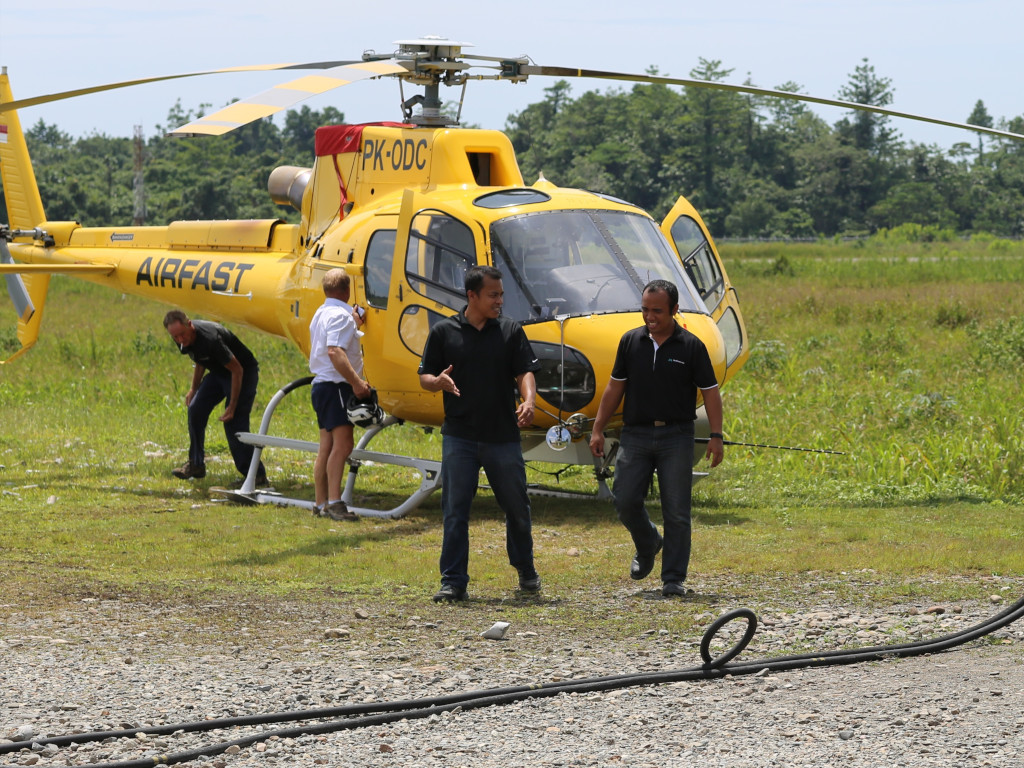
With my colleague, Imam, just after Leica ALS70 LiDAR pod installation on an AS350 helicopter at Timika Airport, West Papua, Indonesia (2014)
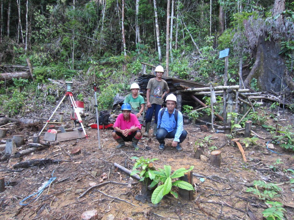
With my surveying crew, drill collar survey with Leica GS15, Central Borneo, Indonesia (2013)
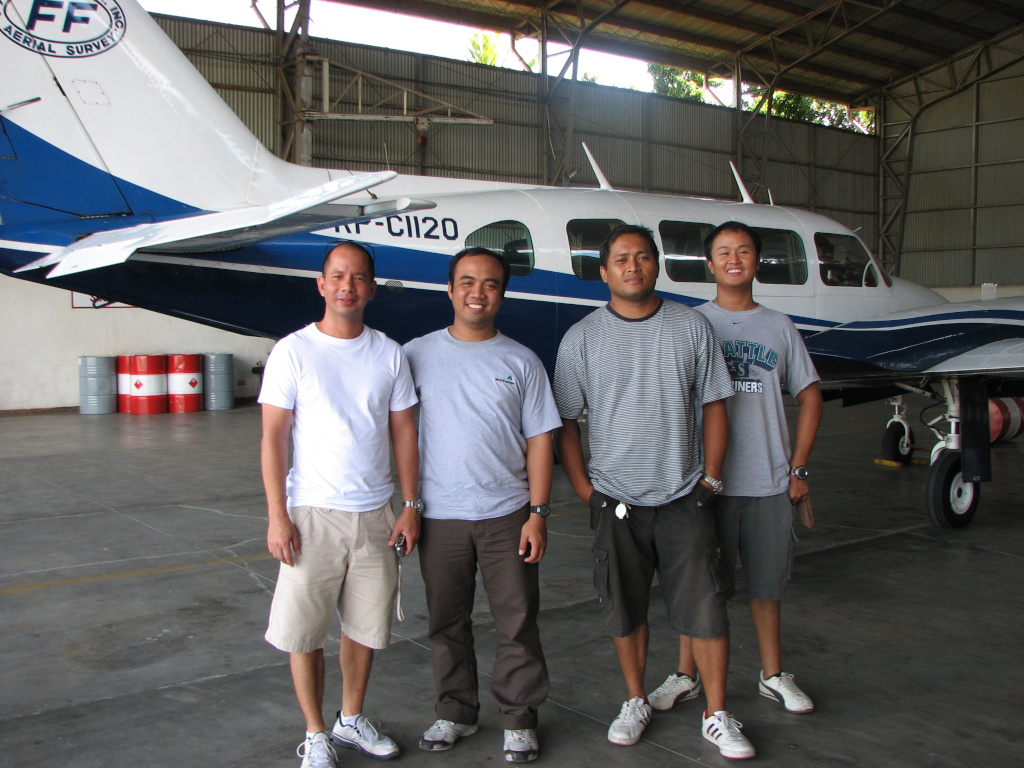
Posing with the air crew of FF Cruz's Piper PA-31 Navajo, at the conclusion of a LiDAR survey, Davao, Phillippines (2011)
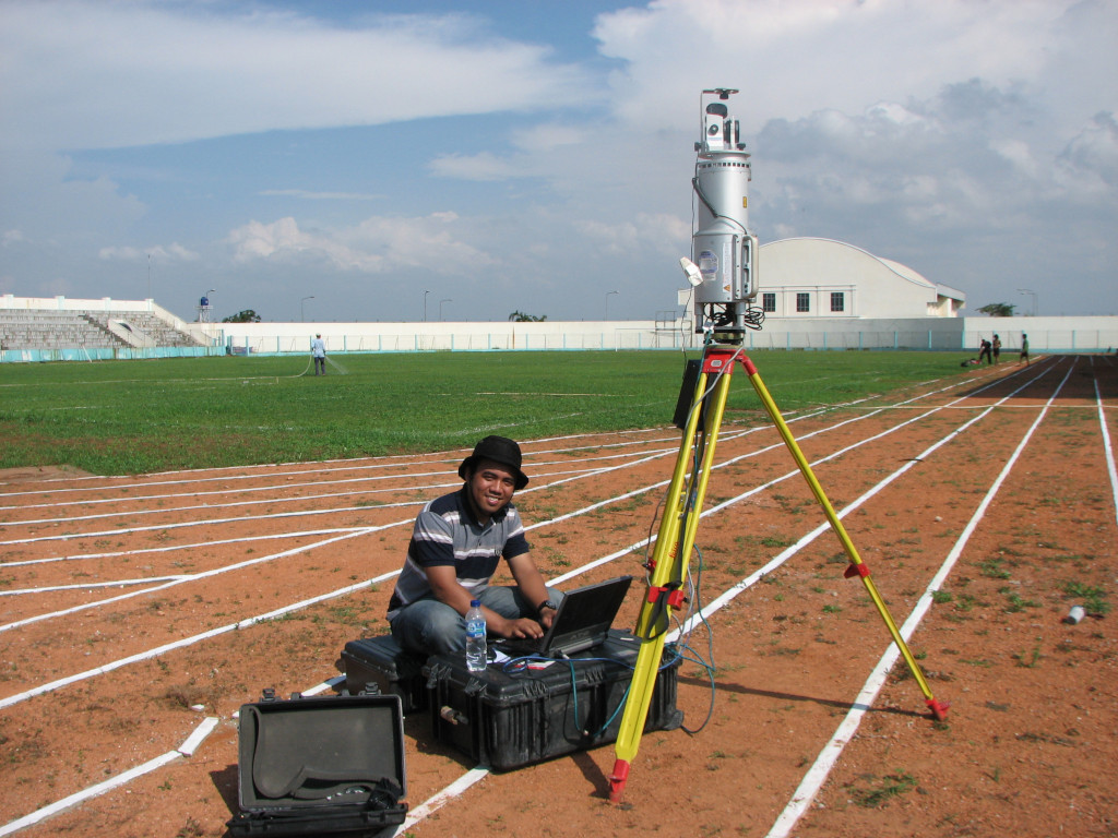
Scanning a sports stadium with Riegl LMS-Z420i, North Jakarta, Indonesia (2011)
Production Coordinator / GIS Database Administrator / Sales Engineer
PT ExsaMap Asia, Jakarta — Jun 2004 – Dec 2010
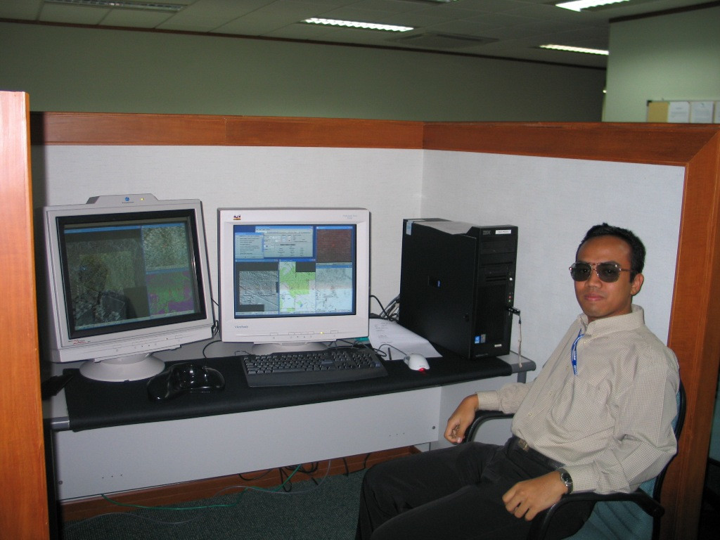
At my digital photogrammetry workstation, Jakarta, Indonesia (2005)
Technical Staff
PT Exsa Internasional, Jakarta — Dec 2003 – May 2004
Topographic Surveyor (Freelance)
Various Projects, Yogyakarta — Aug 2003 – Nov 2003
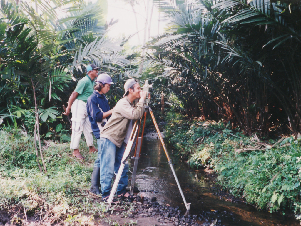
Surveying a creek leading to a proposed reservoir site, Yogyakarta, Indonesia (2001)
Lecturer Assistant
Universitas Gadjah Mada, Yogyakarta — Apr 2001 – Jul 2003
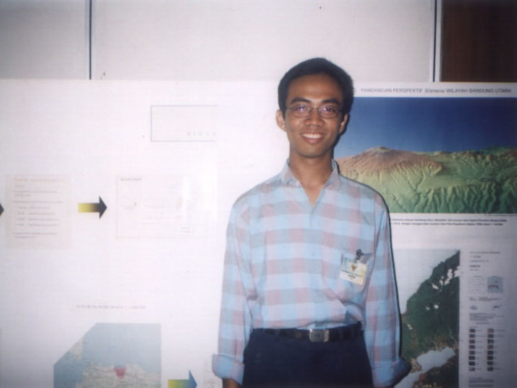
At the headquarters of National Coordinating Agency for Survey and Mapping, Jakarta, Indonesia (2001)